Home
Login
The Neilston WebCam Photo Gallery
A personal photographic tour of Scotland
The Neilston Webcam
Album list
Last uploads
Last comments
Most viewed
Top rated
My Favourites
By date
Search
Home
>
Neilston and Renfrewshire Area
>
Countryside around Neilston
FILE 768/1453
Download Picture
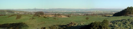
East Renfrewshire Community Woodland, 2007
Opened in 1995 this photo taken in winter 2007 shows the growth in the trees since then. Craighall Dam can be seen though the trees.
Map location.
Rate this file
(No vote yet)
Javascript must be enabled in order to vote
File information
Filename:
East_Renfrewshire_Community_Woodland,_2007.jpg
Album name:
administrator
/
Countryside around Neilston
Filesize:
547 KiB
Date added:
Sep 23, 2009
Dimensions:
1597 x 1061 pixels
Displayed:
471 times
URL:
http://www.drookitagain.co.uk/coppermine/displayimage.php?pid=2171
Favourites:
Add to Favourites
Add your comment
Anonymous comments are not allowed here.
Log in
to post your comment


![East Renfrewshire Community Woodland, 2007
Opened in 1995 this photo taken in winter 2007 shows the growth in the trees since then. Craighall Dam can be seen though the trees. [url=http://www.streetmap.co.uk/map.srf?X=247244&Y=654977&A=Y&Z=115/] Map location. [/url]](albums/userpics/10001/normal_East_Renfrewshire_Community_Woodland%2C_2007.jpg "Click to view full size image
==============
East Renfrewshire Community Woodland, 2007
Opened in 1995 this photo taken in winter 2007 shows the growth in the trees since then. Craighall Dam can be seen though the trees. [url=http://www.streetmap.co.uk/map.srf?X=247244&Y=654977&A=Y&Z=115/] Map location. [/url]")