Home
Login
The Neilston WebCam Photo Gallery
A personal photographic tour of Scotland
The Neilston Webcam
Album list
Last uploads
Last comments
Most viewed
Top rated
My Favourites
By date
Search
Home
>
Highland Region
>
Scenery of Skye & Lochalsh area
FILE 510/943
Download Picture
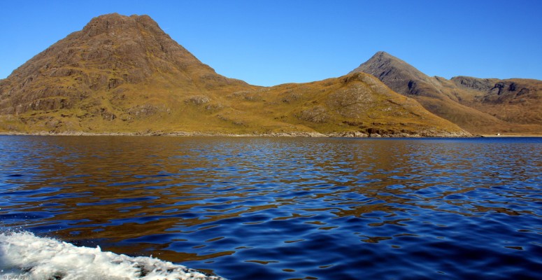
Loch Scavaig, Isle opf Skye
Sgurr na Stri (497m) is on the left and Bla Bheinn (928m) is on the right. The Camasunary Bothy can be seen in the distance near the shore.
Map location.
Rate this file
(No vote yet)
Javascript must be enabled in order to vote
File information
Filename:
Loch_Scavaig.jpg
Album name:
administrator
/
Scenery of Skye & Lochalsh area
Filesize:
760 KiB
Date added:
May 11, 2019
Dimensions:
1988 x 1026 pixels
Displayed:
323 times
DateTime Original:
2013:10:12 12:01:09
Exposure Time:
1/200 sec
FNumber:
f/10
Flash:
No Flash
Focal length:
18 mm
Model:
Canon EOS 40D
X Resolution:
72 dots per ResolutionUnit
Y Resolution:
72 dots per ResolutionUnit
URL:
http://www.drookitagain.co.uk/coppermine/displayimage.php?pid=6116
Favourites:
Add to Favourites
Add your comment
Anonymous comments are not allowed here.
Log in
to post your comment