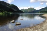
A dam at the eastern end of Loch Loyne provides a head of water for the Garry-Moriston Hydo scheme. A tunnel carries water north from here to the Cluanie dam. This view point is littered with small cairns left by tourists. Map location.
Rate this file (Current rating : 5 / 5 with 1 votes)


![Loch Loyne panorama
A dam at the eastern end of Loch Loyne provides a head of water for the Garry-Moriston Hydo scheme. A tunnel carries water north from here to the Cluanie dam. This view point is littered with small cairns left by tourists. [url=http://www.streetmap.co.uk/map.srf?X=218612&Y=804770&A=Y&Z=115&ax=218612&ay=804770/] Map location. [/url]](albums/userpics/10001/normal_Loch_Garry_panorama.jpg "Click to view full size image
==============
Loch Loyne panorama
A dam at the eastern end of Loch Loyne provides a head of water for the Garry-Moriston Hydo scheme. A tunnel carries water north from here to the Cluanie dam. This view point is littered with small cairns left by tourists. [url=http://www.streetmap.co.uk/map.srf?X=218612&Y=804770&A=Y&Z=115&ax=218612&ay=804770/] Map location. [/url]")